PressureXpress
Reservoir pressure while logging service
Obtain accurate pressure and mobility measurements on the first logging run—in less than a minute.
Automated subsurface feature extraction

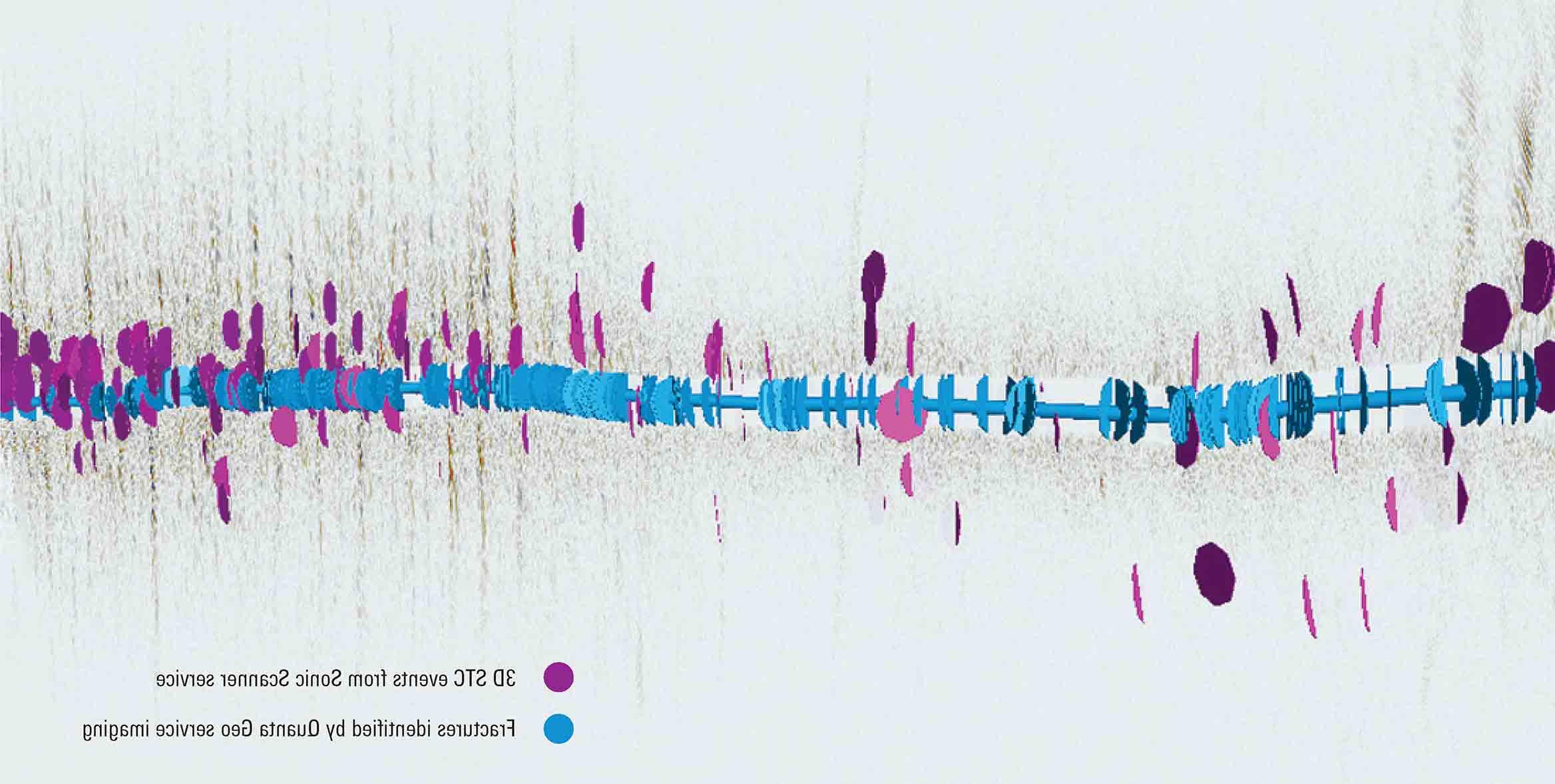
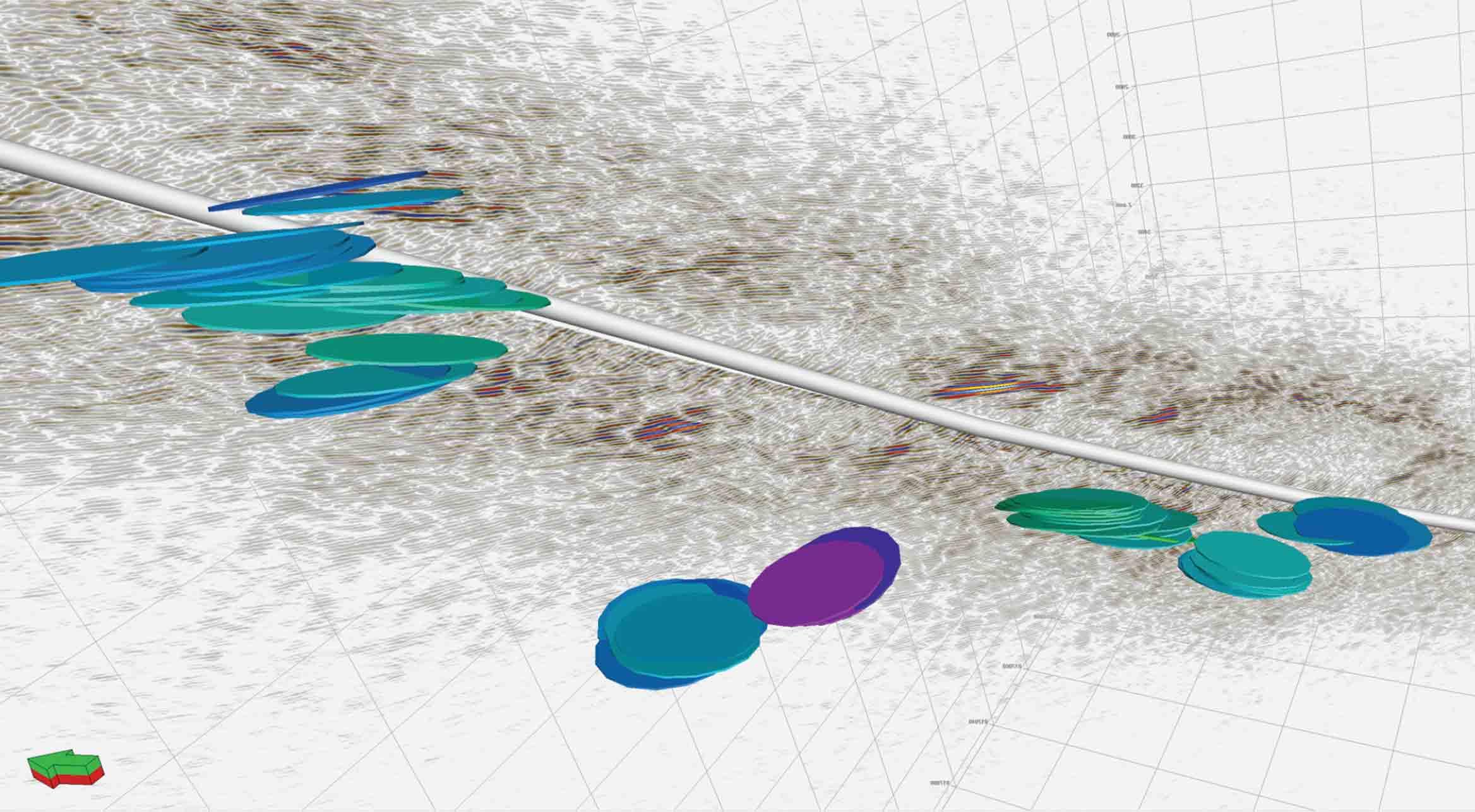
The 3D far-field sonic service extends sonic imaging far beyond the reach of standard sonic logging while also providing true dip and azimuth. The service automates what were previously manual tasks to efficiently and accurately determine connectivity for open fractures and identify subseismic structural features and formation layers, tracing them from the borehole wall through the near-field and far-field reservoir. You’ll significantly advance modeling of fractured reservoirs or conducting structural analysis with these rich far-field datasets and interpretations. Now, data can be acquired using a standard sonic tool, slim dipole tool on wireline, or through-the-bit logging conveyance.

Enhanced telemetry acquires 3D far-field and standard sonic data at up to 3× the speed of conventional sonic logging. This provides an efficient opportunity to look at far-field reservoir imaging. Using this rich dataset, the new automated workflow rapidly delivers consistent, precise quantitative results up to 10× faster than conventional processing and analysis to bring new insight to understanding the reservoir.
The 3D far-field sonic service integrates results from borehole imaging logs to trace features from the near- to far-field reservoir. This seamless combination validates the near-wellbore structural environment while providing continuity for features that intersect the wellbore—as well as identifying and accurately placing those that don’t and would be otherwise undetected.